While bicycling the Greg Smith River Trail recently, my attention was drawn to inviting scenes through the dense line of trees and lush vegetation bordering the base of the levee.
Inlets formed by the buffer islands separating the swirling waters of the Arkansas River and the mainland were very picturesque. I spotted distant birds in flight, skimming across the water, then disappearing into the dense canopy of trees that cover the islands.
I wanted to explore this backwater ecosystem.
Two days later, exchanging bicycle for kayak, I returned to the riverfront with several friends to enjoy it from a totally different perspective, the Water Trail.
Our adventure began at the Powers Port Canoe Access on Riverfront Drive. This safe put-in was created through joint efforts of the Arkansas Canoe Club, Arkansas Game & Fish Commission and Fort Smith Parks and Recreation.
Canoe club member Ron Robbins obtained a recreational right-of-way agreement from the Powers family that owns this land, making the put-in possible. Bill Hanna of Hanna Oil & Gas donated the labor and equipment to clear the shore, construct a boat ramp and drop loads of boulders to create a protective barrier around the put-in during high water.
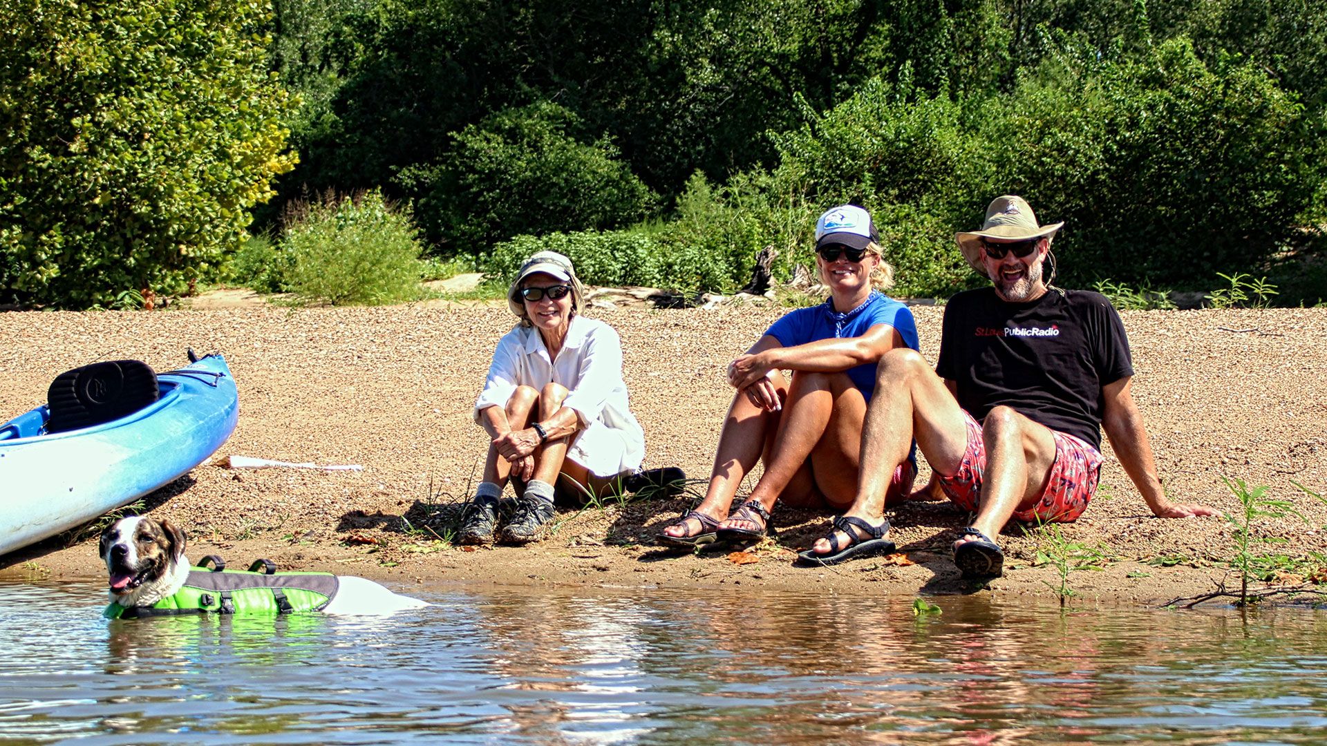
As Nancy Raney and I turned at the battered aluminum canoe that towers some 20 feet above the driveway to the access point’s parking lot, our friends Trish Flannagan, co-founder of Fort Smith’s Future School, and fiancee Sam Bernadene followed close behind.
Steve and Pam Yancey arrived shortly afterward to round out our team of adventurous explorers. Steve had been the president of the Arkansas Canoe Club River Valley chapter when the water trail was created in 2012.
We collected our gear, which included life jackets per Arkansas law, then lugged the kayaks across the bike path to the put-in, on the opposite side of the levee.
When approaching the ramp, there is another maintained path leading off to the right. By following this spur trail another hundred feet, visitors will arrive at a sandy beach, perfect for a game of volleyball or just enjoying a family outing.
This is where George Carney once operated a sand sales operation with Motile Powers as his partner. Bo, son of Motile, told me Carney would excavate sand until they had exhausted the supply. He would shut down operations until the river flooded and washed in more sand.
The route of the water trail, detailed on the AGACE map, shows it to be a lollipop shape. Leaving the put-in, it routes boaters upriver to circle a large island, then returns past the put-in and continues downriver to the Fort Smith Park take-out, approximately a 21⁄2-mile float.
Once our flotilla of kayaks crossed the large open body of calm water at the put-in, we began to cruise along the island shores.
Paddling on still, flat water is slow, the speed of choice for our group. This allowed us to study the beautiful water flora along the shoreline and appreciate the blooming hibiscus.
Social distancing is not an issue for kayakers on the backwater. There are so many interesting sights calling from every direction we each pursued our own agendas.
I was interested in locating a route to connect with the main river channel, so I continued along the shore of one of the large islands. En route, I flushed a great egret. It was impressive watching the long, lanky bird drop from her perch to glide gracefully, mere inches above the water’s surface. An animated kingfisher then flitted from tree to tree, piloting me along the channel.
The islands are much larger in person than they appear on the map. With each bend in the waterway, I was sure the main river would appear. Finally, I docked my kayak on the shore to hike across a narrow sandy peninsula, and there it was, the mighty Arkansas River.
Mission accomplished, I retraced my route to rejoin the others.
We had a couple of kayak stowaways. Pam’s long-haired chihuahua, Sofie, was content to lounge quietly on the bow of her kayak. Trish brought Frank, a large Heinz 57 mix, who alternated between swimming along behind her boat and almost tipping her over as he climbed onboard.
I highly recommend including someone in your flotilla who is knowledgeable in waterfowl and plants. We were lucky to have Sam, a marine biologist. It was like having Alexa along with us.
“Sam, what kind of bird is that?”
“Sam, what flower is that?”
My initial plan had been to circle the big island on the map. However, with so many narrow water channels calling out to us to explore them, and being lured into exotic wonderlands following the lead of fleeing waterfowl, we failed to make it around the big island.
Following two hours of exploring those regions south of Powers Point, we drifted downriver past the put-in to another sandy beach I had seen from the bike path. Pulling ashore, we enjoyed snacks as we lazily lounged about, talking about what we had seen.
Trish and Sam had been lucky enough to spot a pair of deer swimming from one island to another. I am sure there are many animals on these islands who live their entire existence never crossing to the mainland. The string of islands is the only world they know.
At one moment in my kayak, I noticed what appeared to be a shadow over the water surface, but saw no tree above to cast the silhouette. I paddled closer. As the supposed shadow passed my boat, I peered into the water to discover hundreds of tiny fish.
The water trail is just another great way to enjoy Fort Smith’s scenic riverfront, along with the Greg Smith River Trail, the Fort Smith Skate & Bike Park, and soon-to-be-opened U.S. Marshals Museum.
It is possible to dine along Garrison Avenue at one of the many fine establishments and, shortly after, paddle among unspoiled wilderness or enjoy an early-morning rowing workout.
Thanks to the recreational easement Robbins collected from the Powers family, you could camp on one of the many sandy beaches of the east bank of the river or on one of the bordering islands.
With an adjoining 300-plus acres, the city of Fort Smith recently purchased from Kansas City Railroad, opportunities for enjoying this water paradise will only get better.
Writer Bob Robinson is a kayaker, climber, cyclist and world explorer. He has published several cycling guides. Photos by Bob and Nancy Raney, his frequent companion in adventure.